Geocollect Documentation
Choose a section below to start exploring the Geocollect documentation.
📖
Introduction
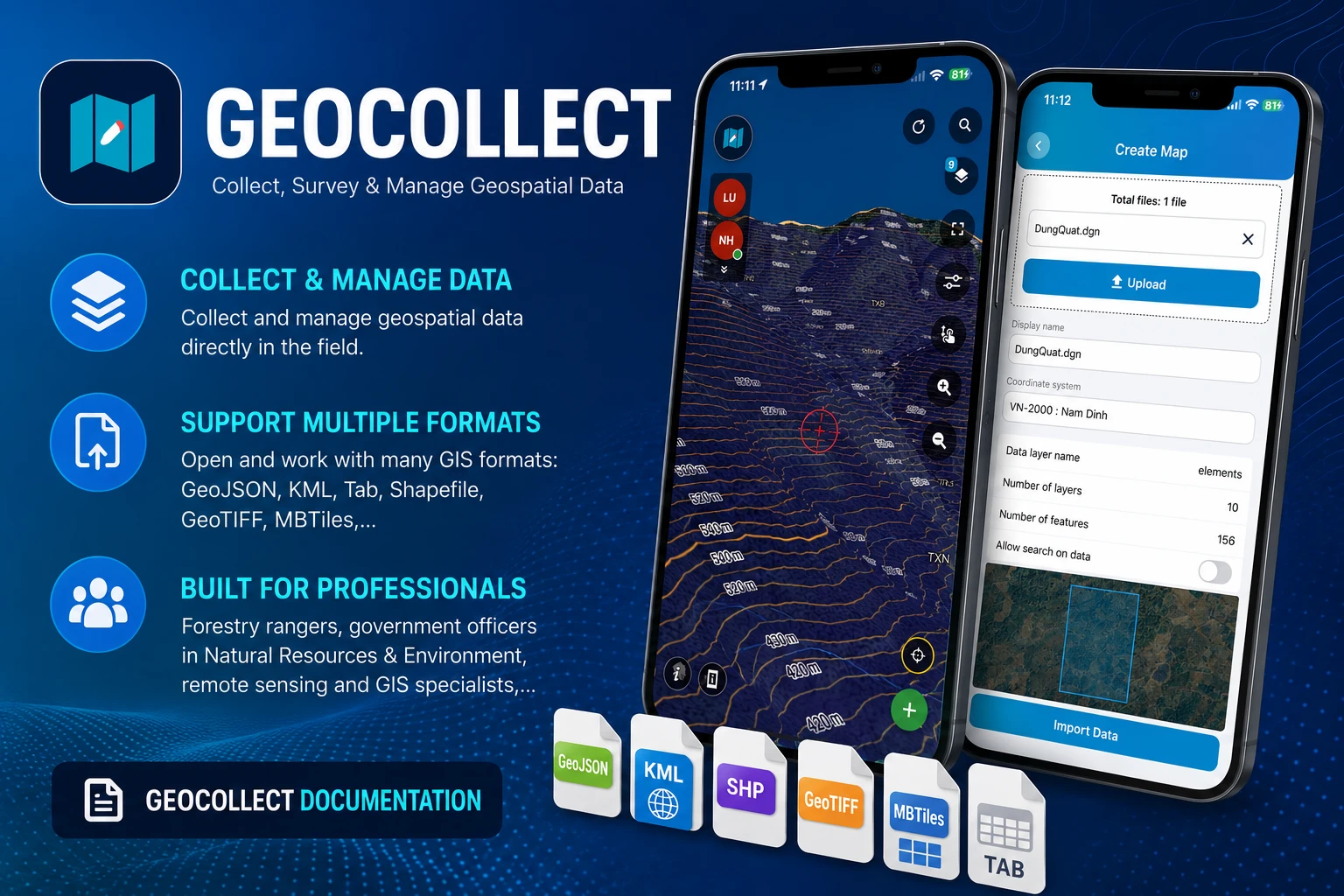
Overview of Geocollect
❓
FAQ
Frequently asked questions
🚀
Tutorial - Basic
5 minutes to learn the most important features
2026-01-01
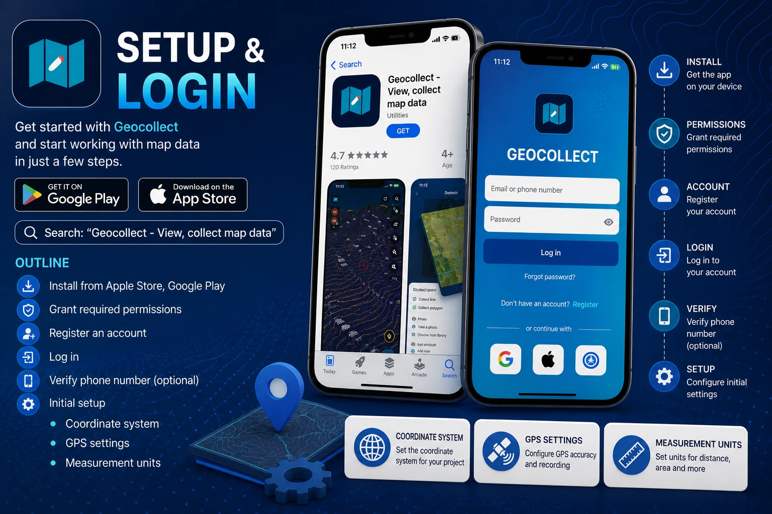
Installation
TLGeo
2026-01-01
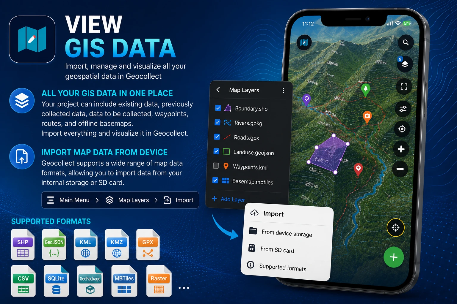
Viewing GIS Data
TLGeo
2026-01-01
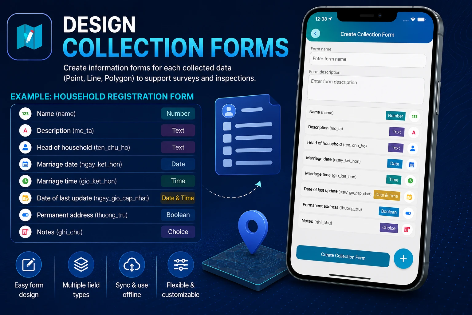
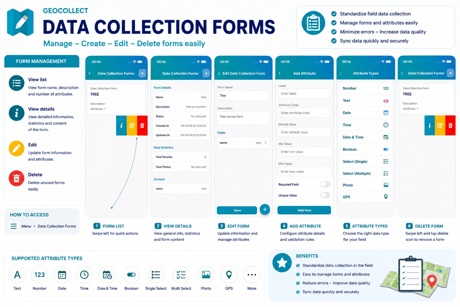
Designing Data Collection Forms
TLGeo
2026-01-01
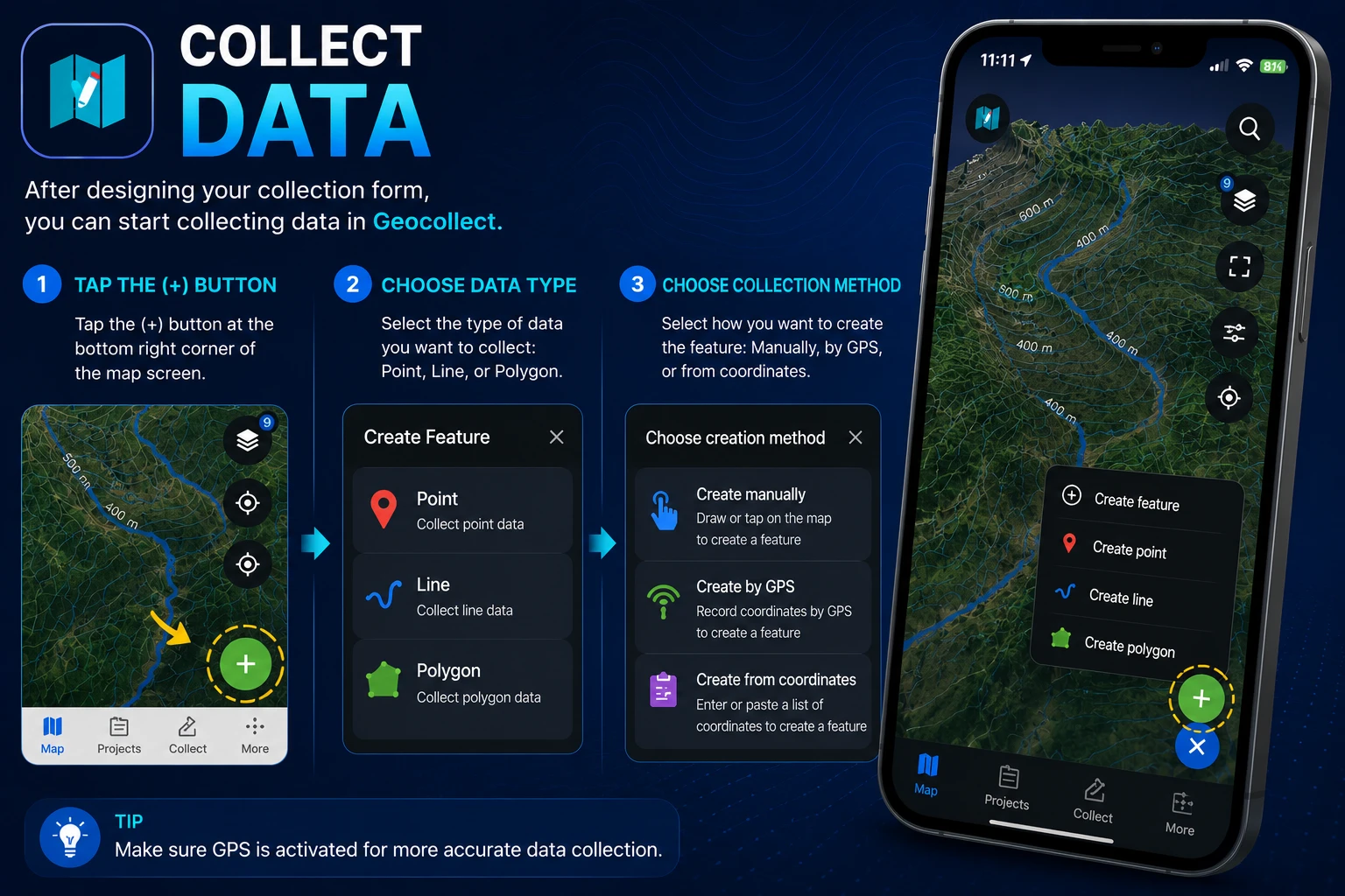
Data Collection
TLGeo

2025-01-01
Manage Collected Data
TLGeo
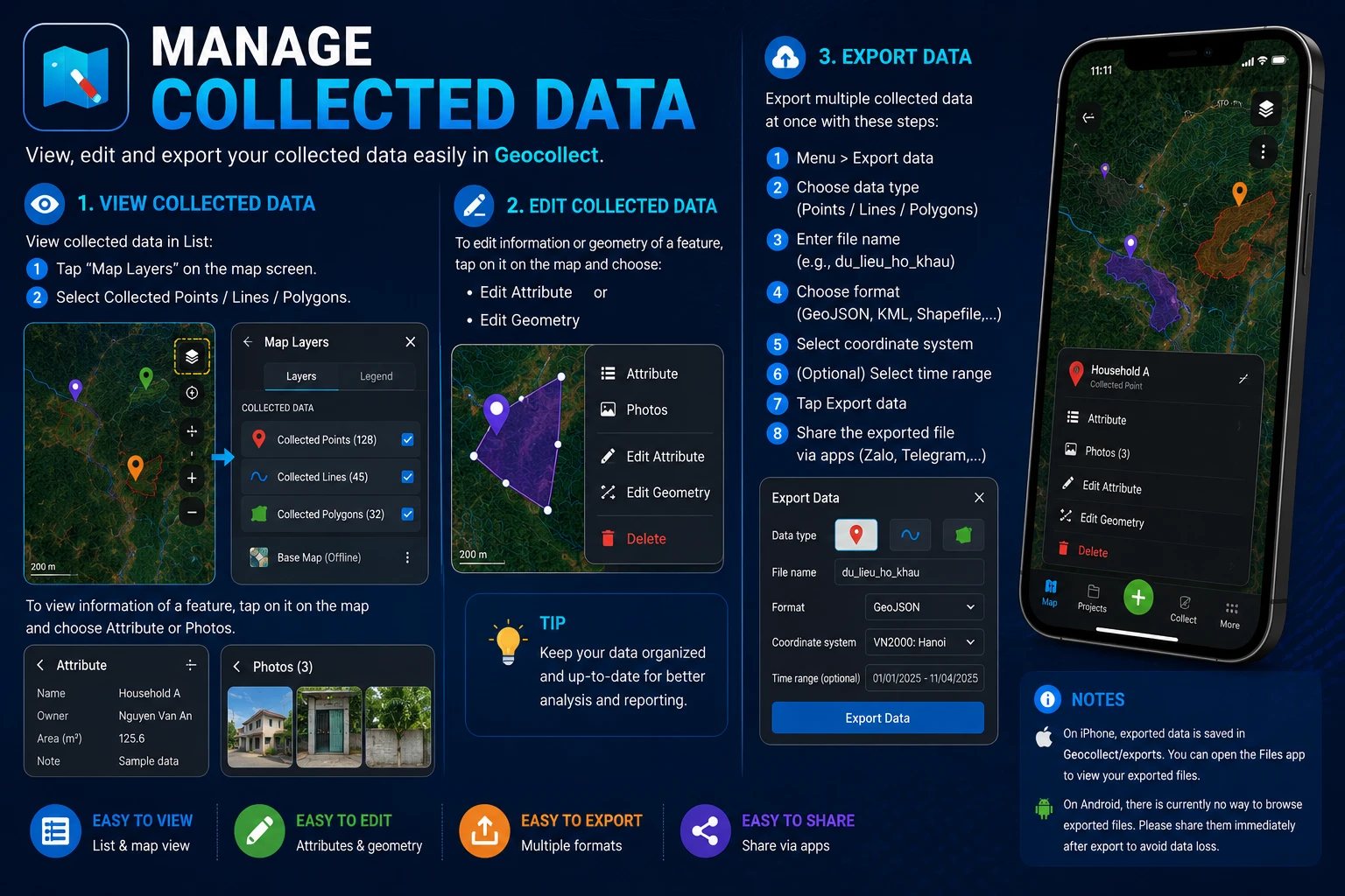
2026-01-01
Export Collected Data
TLGeo
⚡
Tutorial - Advance
Advanced tutorials
2026-01-01
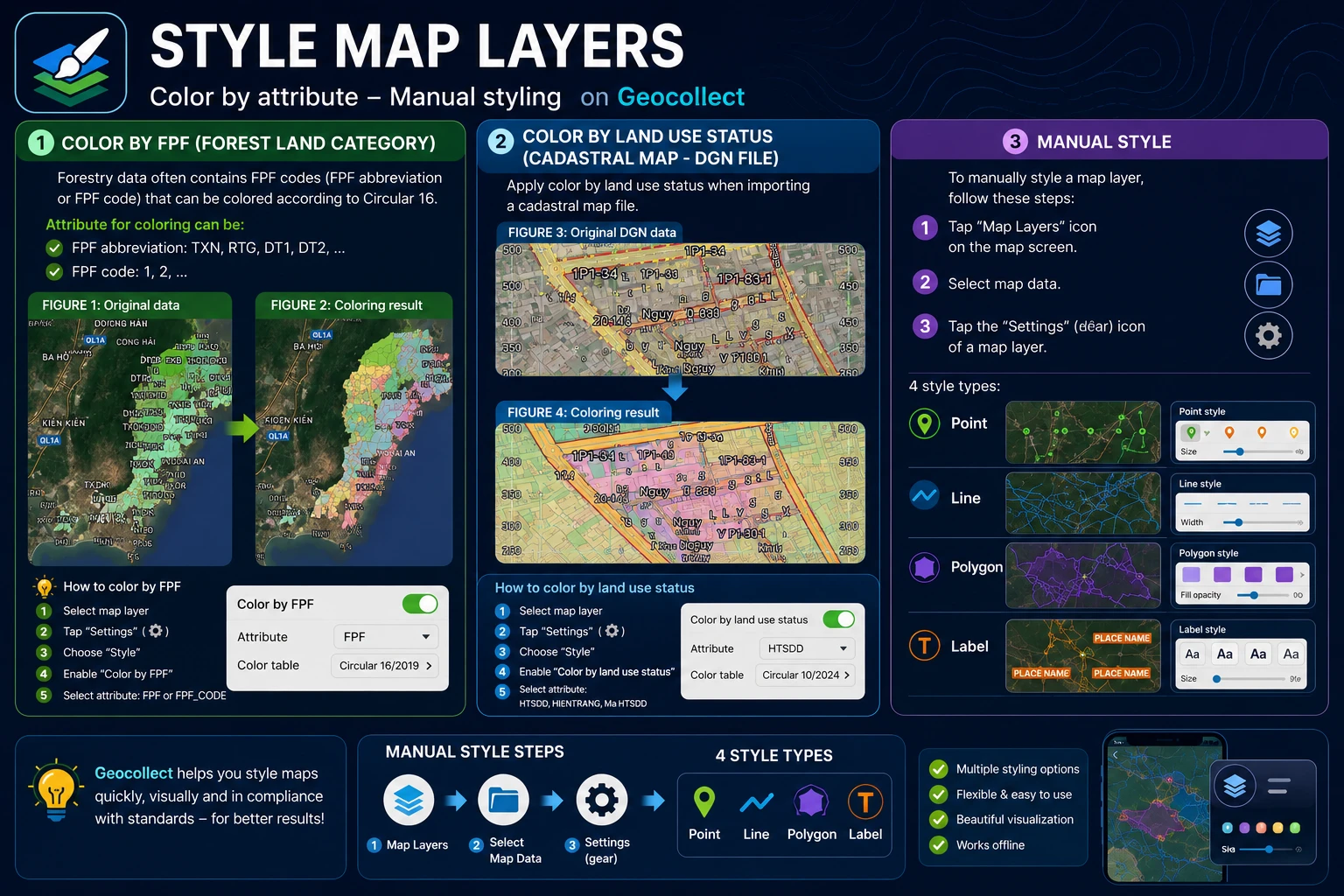
Map Layer Styling
TLGeo
2025-01-01
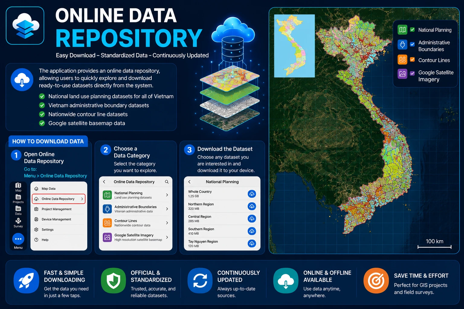
Online Data Store
TLGeo
2025-01-01
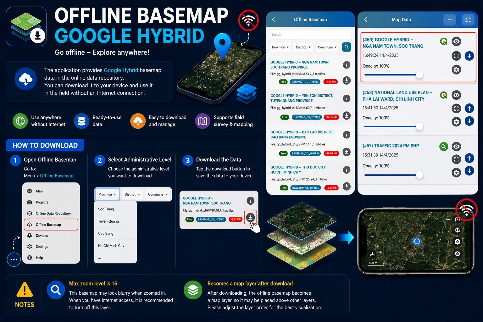
Offline Basemap
TLGeo
2025-01-01
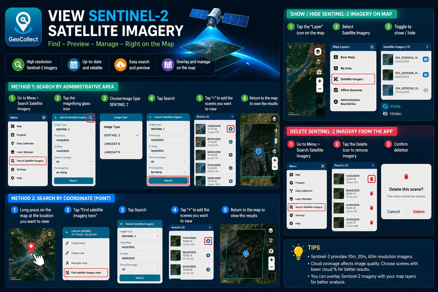
Sentinel 2 Satellite Imagery
TLGeo
2025-01-01
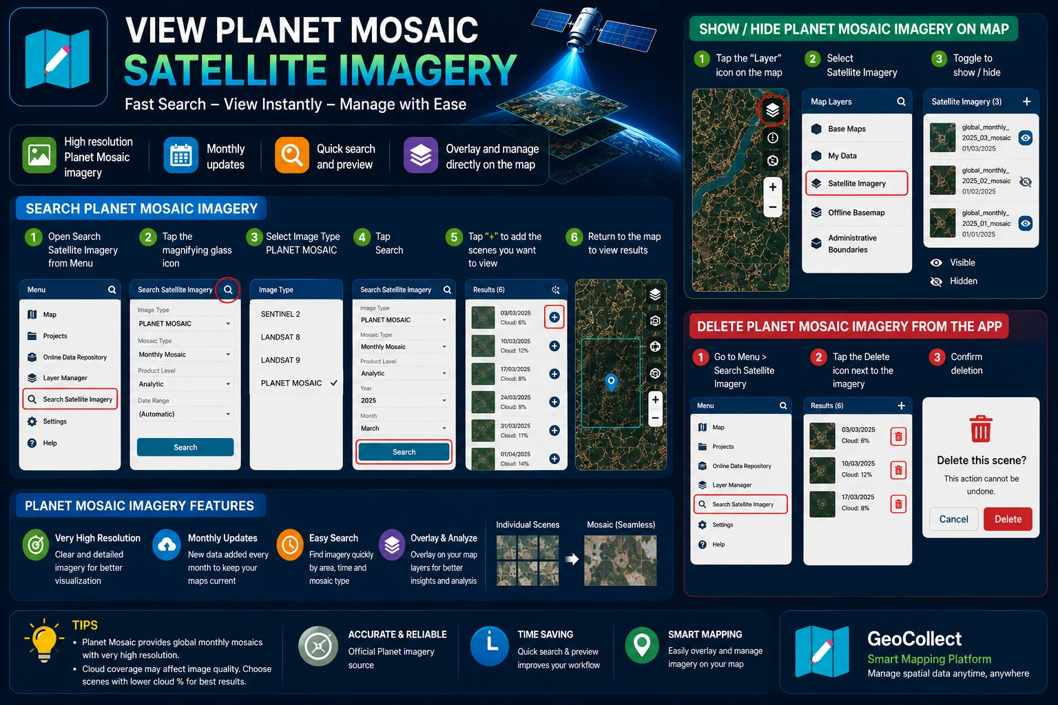
PLANET MOSAIC Satellite Imagery
TLGeo
2026-01-01
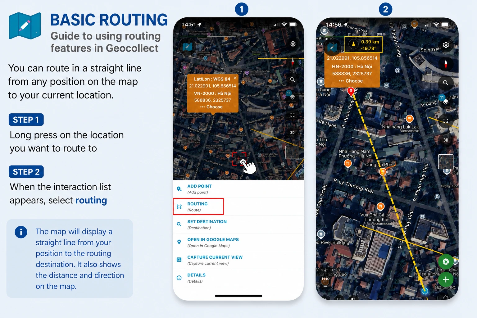
Basic Routing
TLGeo
2025-01-01
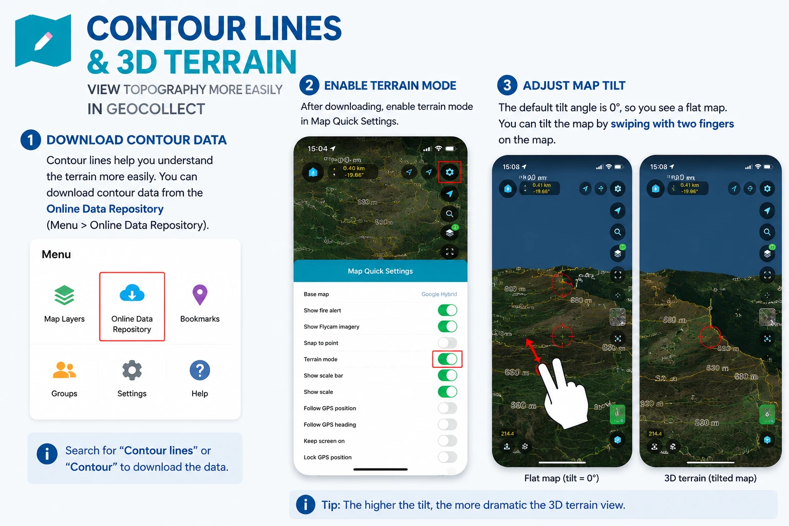
Contour Map and 3D Terrain
TLGeo
2025-01-01
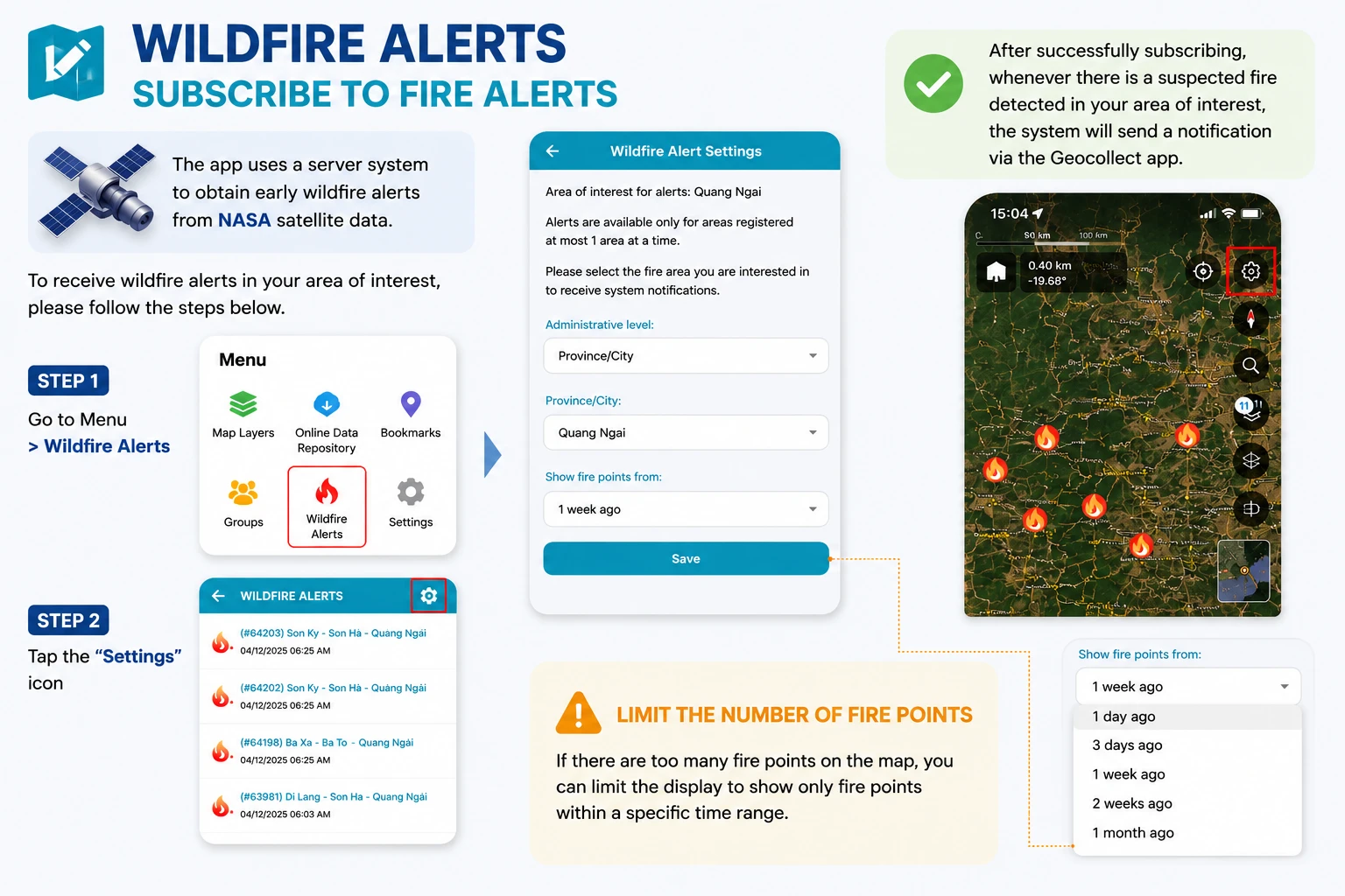
Forest Fire Alert
TLGeo
2025-01-01
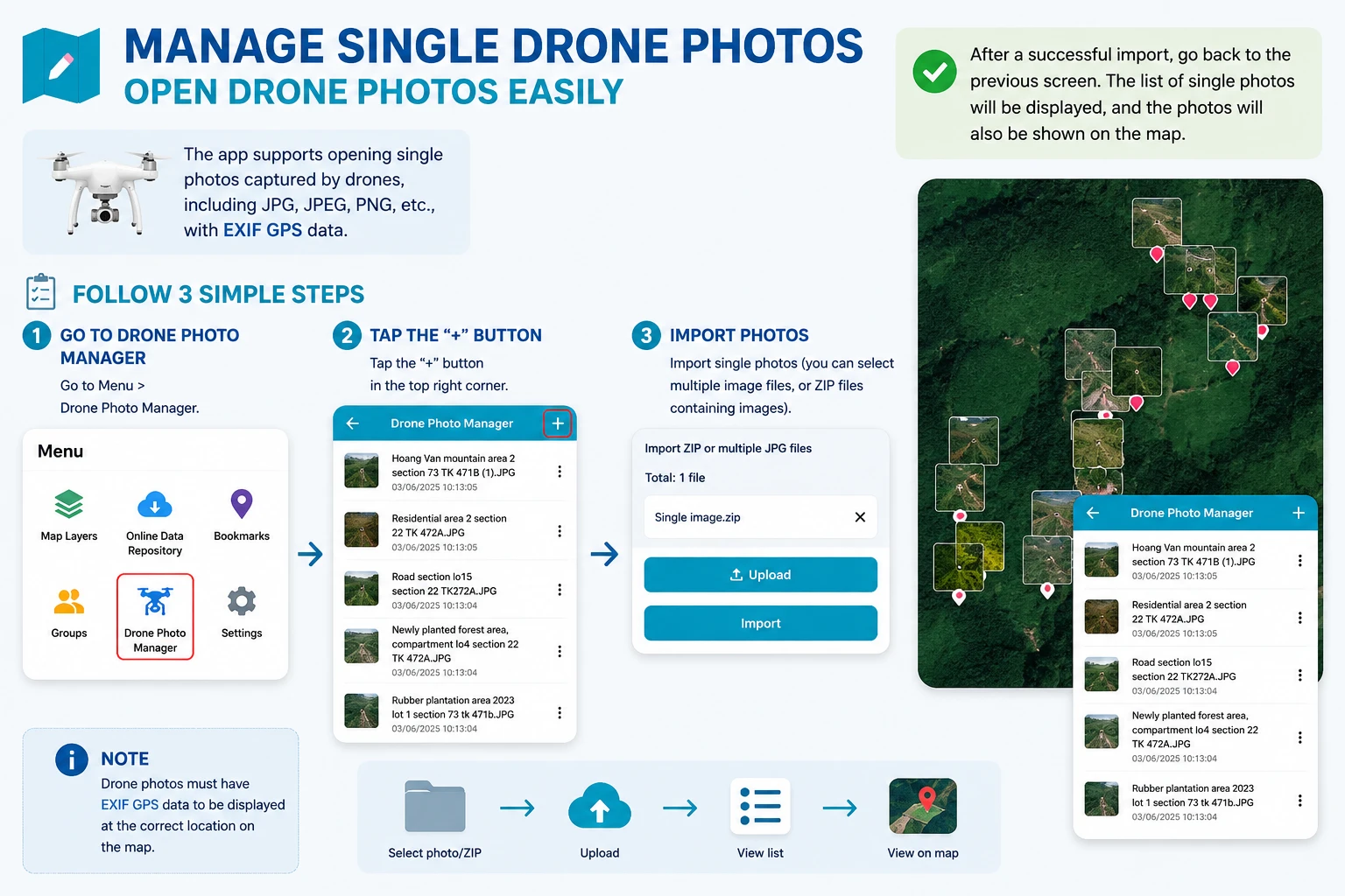
Flycam Single Image Management
TLGeo
2025-01-01
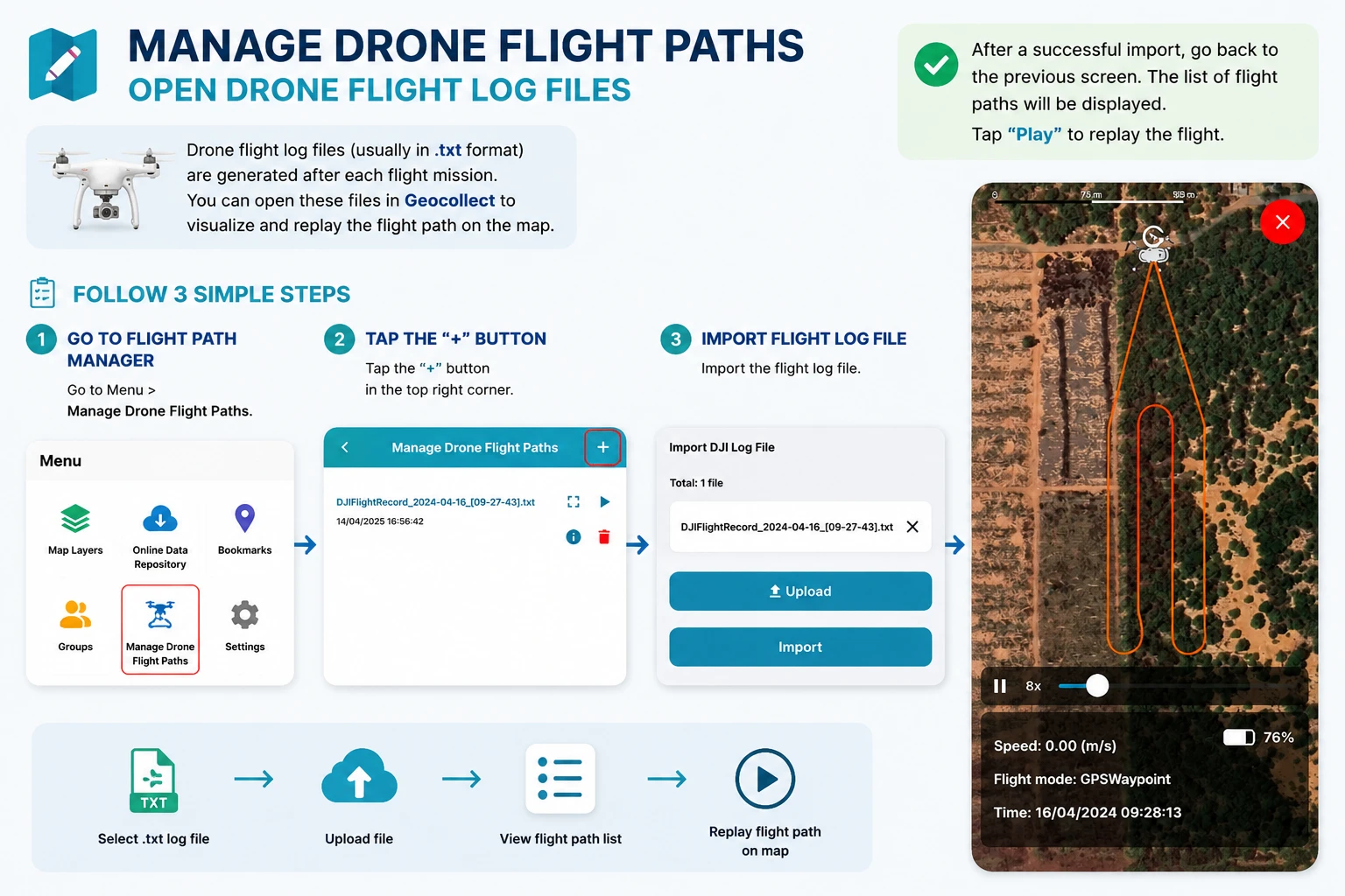
Flycam Flight Path Management
TLGeo
2025-01-17
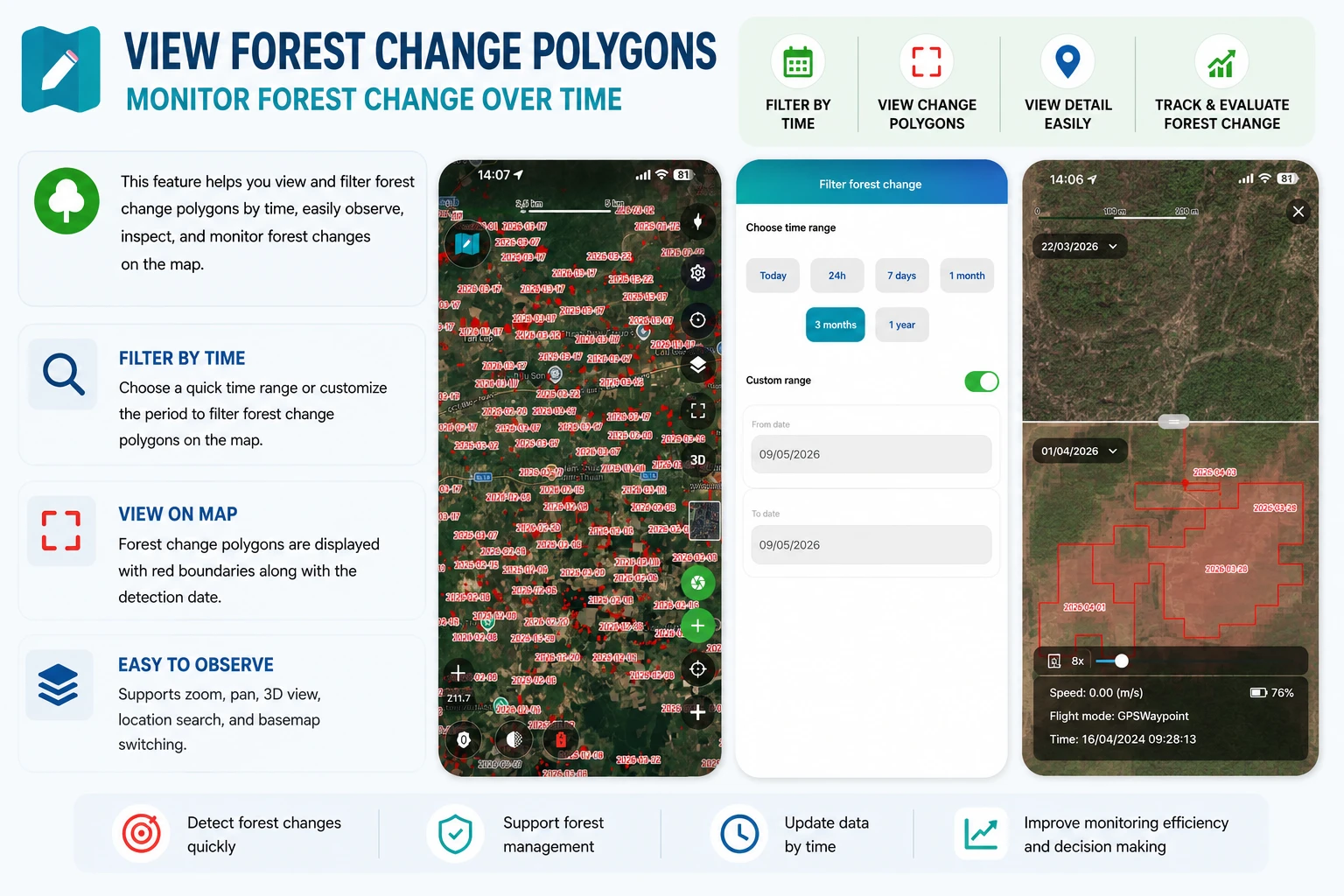
View Forest Change Detection Parcels
TLGeo
📋
References
Screens and detail description
2026-01-01
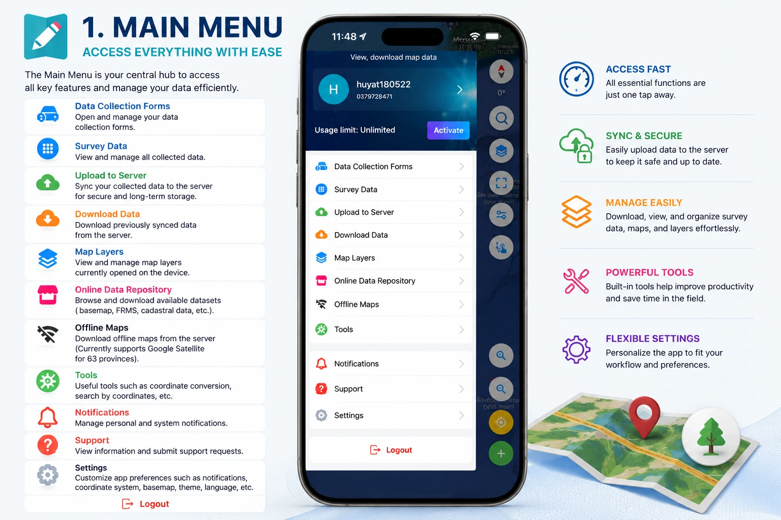
Main menu
TLGeo
2026-01-01
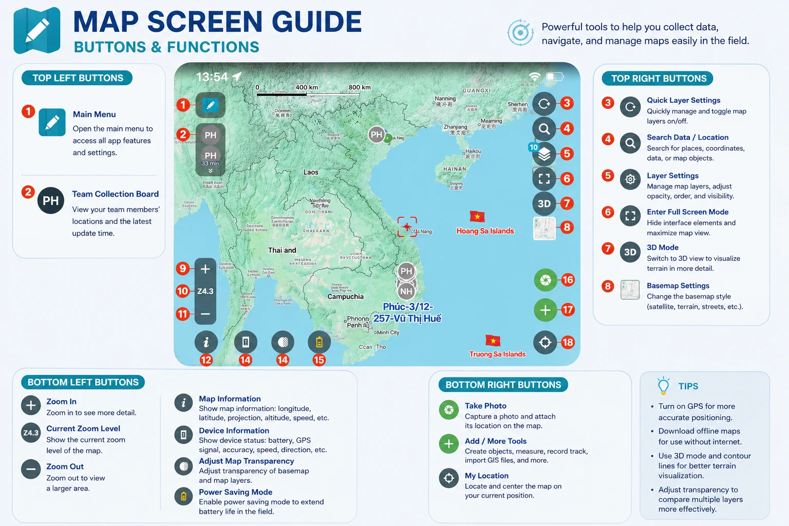
Map screen
TLGeo
2026-01-01
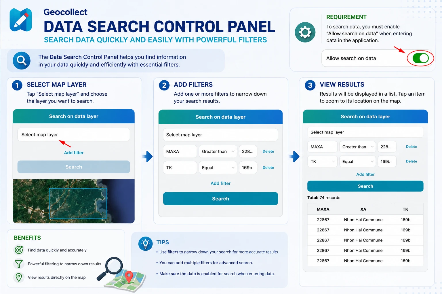
Search panel
TLGeo
2026-01-01
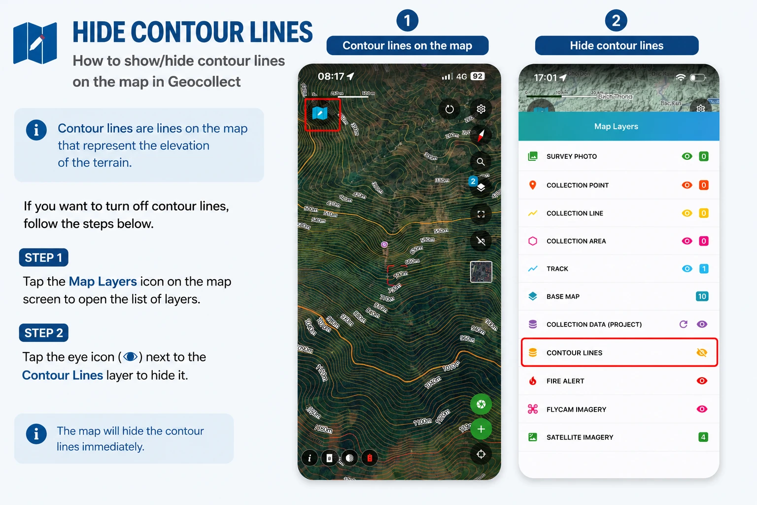
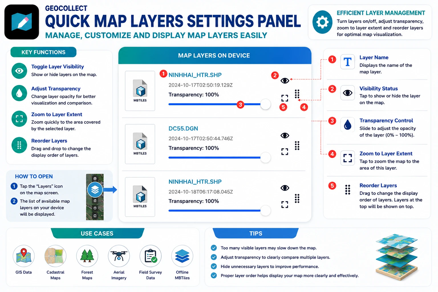
Map layer quick settings
TLGeo
2026-01-01
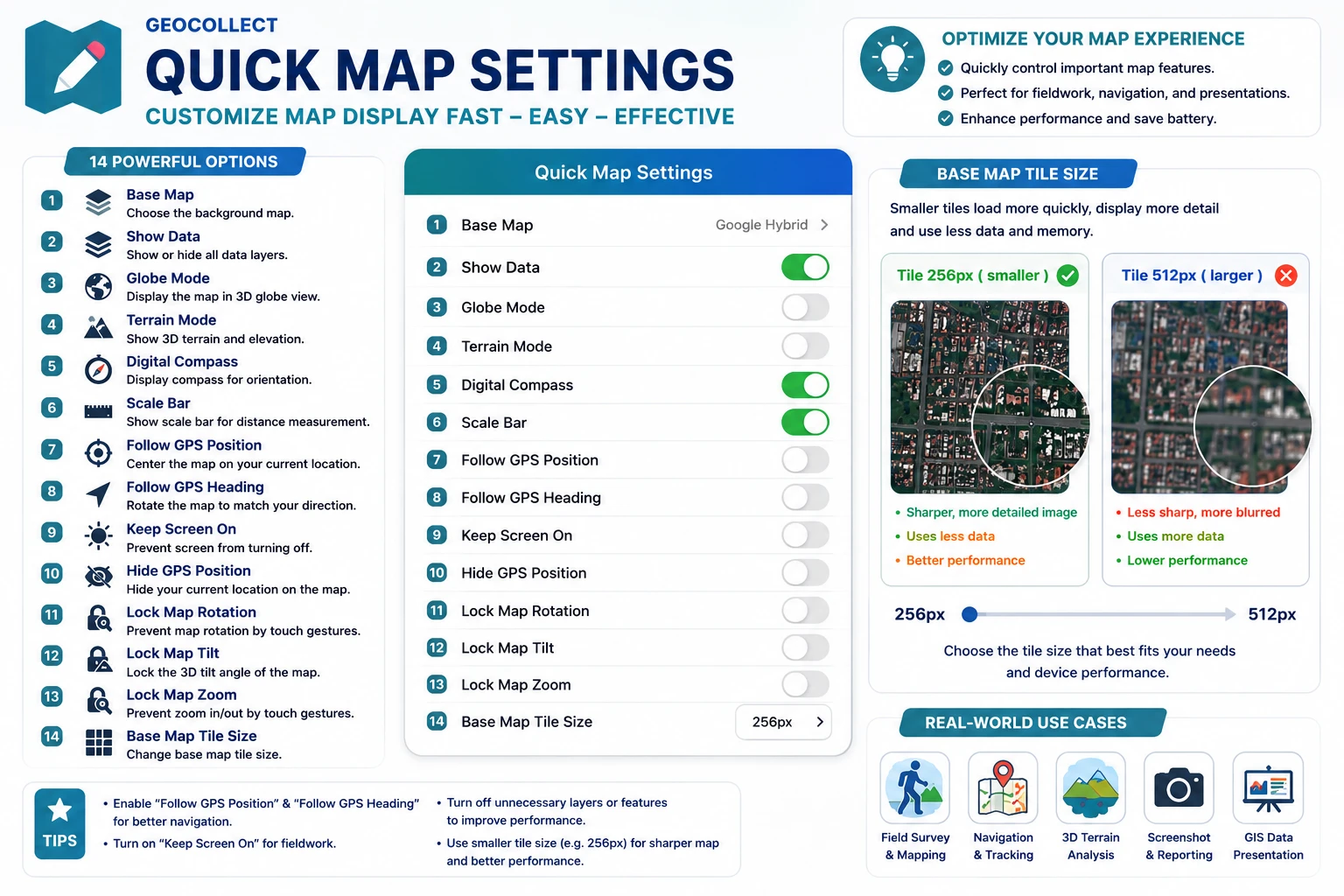
Map quick settings
TLGeo
2026-01-01
Collect form screen
TLGeo
2026-01-01
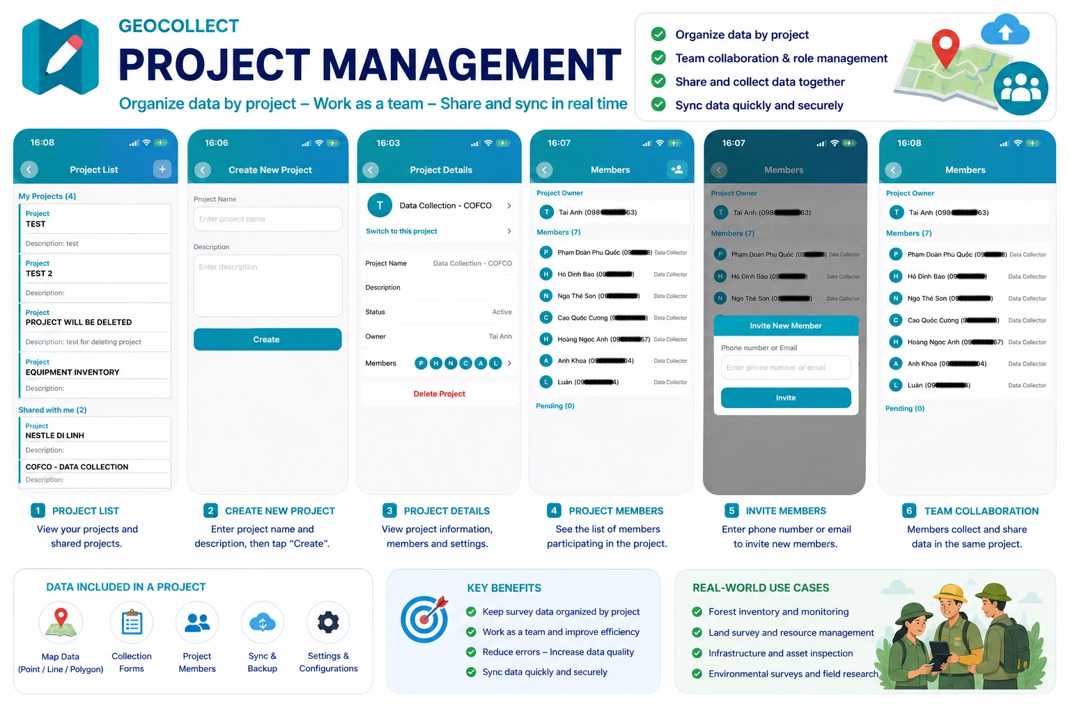
Project screen
TLGeo
📄
2026-01-01
Organization screen
TLGeo
📄
2026-01-01
Collect data screen
TLGeo
📄
2026-01-01
Map layers screen
TLGeo
📄
2026-01-01
Tool screen
TLGeo
📄
2026-01-01
Online map data screen
TLGeo
📄
2026-01-01
Offline basemap screen
TLGeo
📄
2026-01-01
Notification screen
TLGeo
📄
2026-01-01
Support screen
TLGeo
📄
2026-01-01
Settings screen
TLGeo
📄
2026-01-01
Login screen
TLGeo
📄
2026-01-01
Register screen
TLGeo
📄
2026-01-01
Organization Benefits - User Guide
TLGeo