GIS Technology & News
Explore practical articles about GIS, geographic data, programming and product development.
News
1 bài viết
GIS
8 bài viết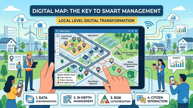
May 5, 2026
Digital Maps: The "Key" to Transforming Grassroots Administrative Management
Discover 4 important pillars that digital map systems bring to grassroots administrative management: data synchronization, specialized management, smart decision-making, and citizen monitoring.
May 5, 2026
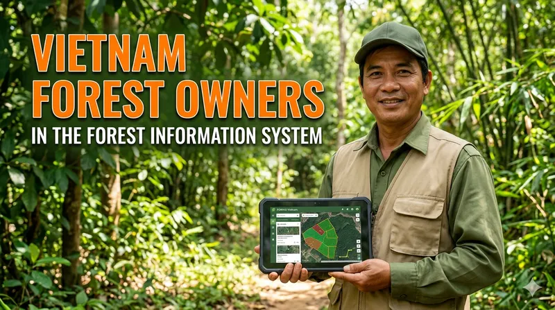
Digital Transformation in Forestry: A Powerful "Virtual Assistant" for Vietnamese Forest Owners
Discover the real benefits of Forest Information Systems (FIS) for Vietnamese forest owners: forest management, profit optimization, FSC/PEFC certification, and carbon credits.
April 27, 2026
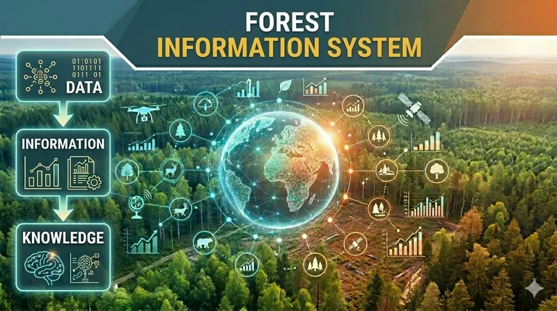
Introduction to Forest Information Systems (FIS)
Learn about Forest Information Systems (FIS): concepts, importance, types of systems, components, and benefits in sustainable forest management.
April 26, 2026
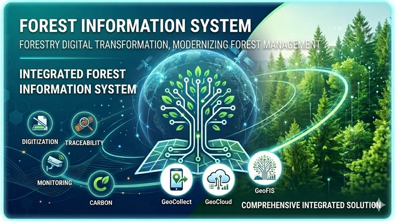
Modernizing Forest Management: From Field Challenges to a Comprehensive Forest Information System
In the digital transformation era, forestry faces a paradox: increasingly large management areas, stricter international certification requirements, yet management methods at many locations remain stuck with notebooks and paper maps. This article analyzes challenges and proposes FIS solutions from TLGeo.
April 22, 2026
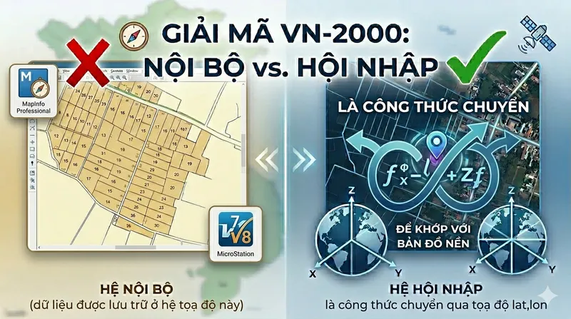
Decode VN-2000: Internal vs. International – Why Your Map Is Off by Hundreds of Meters?
When importing MapInfo or Microstation .dgn data into GeoCollect, maps shift by hundreds of meters relative to the base map. The root cause is confusion between two VN-2000 coordinate systems. This article decodes the role of proj string +towgs84 and how to choose the right coordinate system.
April 8, 2026
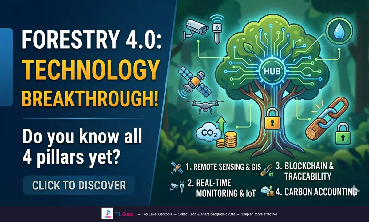
Technology Applications for Forestry — Forestry 4.0 Trends
Explore 4 key technology pillars in modern forestry: remote sensing, IoT monitoring, blockchain traceability and carbon estimation — helping transition from manual management to Forestry 4.0.
April 5, 2026
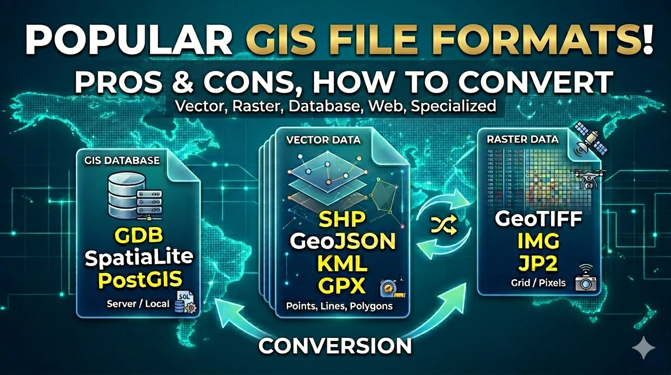
Common GIS File Formats Explained
A comprehensive guide to GIS file formats — from vector (SHP, GeoJSON, KML...) and raster (GeoTIFF...) to databases (GDB, SpatiaLite...) — including how to convert between them.
April 5, 2026
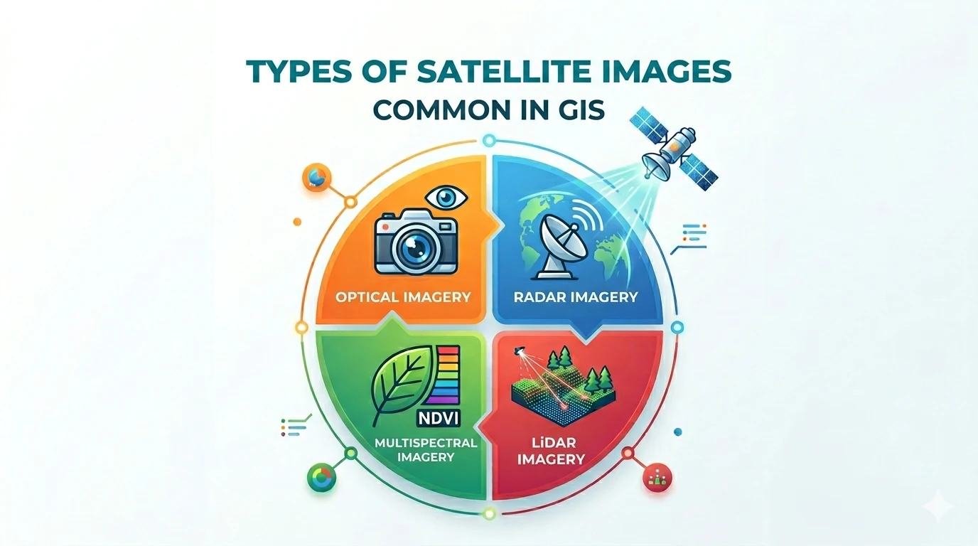
Types of Satellite Imagery Used in GIS
Explore the various types of satellite imagery used in GIS — from optical and radar to multispectral and LiDAR — and learn how to choose the right imagery for your project.
Viễn thám
1 bài viết
Remote Sensing
1 bài viết
Product
1 bài viết

Kết nối với TLGeo ngay
Chúng tôi muốn là một phần công nghệ của doanh nghiệp bạn, mỗi giải pháp chúng tôi phát triển là một công việc của khách hàng được giải quyết.
+84.363.077.359