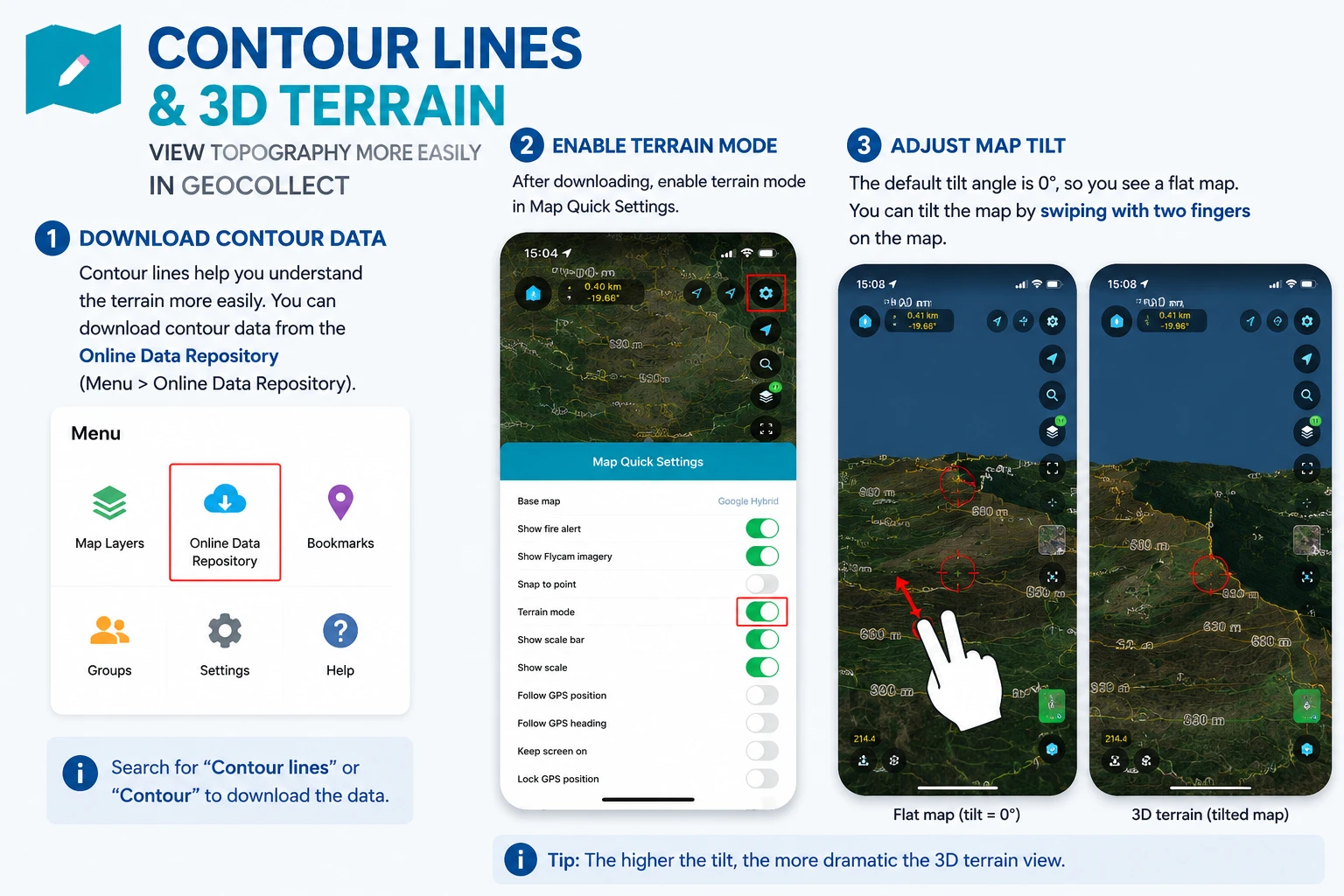
Contour Map and 3D Terrain
Download Contour Data
Contour lines help you view terrain more easily. You can download contour data in the Online Data Store (Menu > Online Data Store)
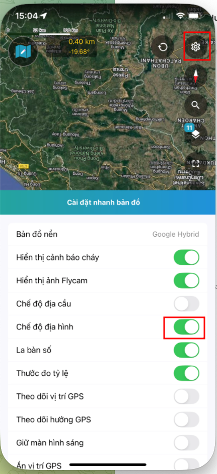
Enable Terrain Mode
After downloading, enable terrain mode in Quick Map Settings
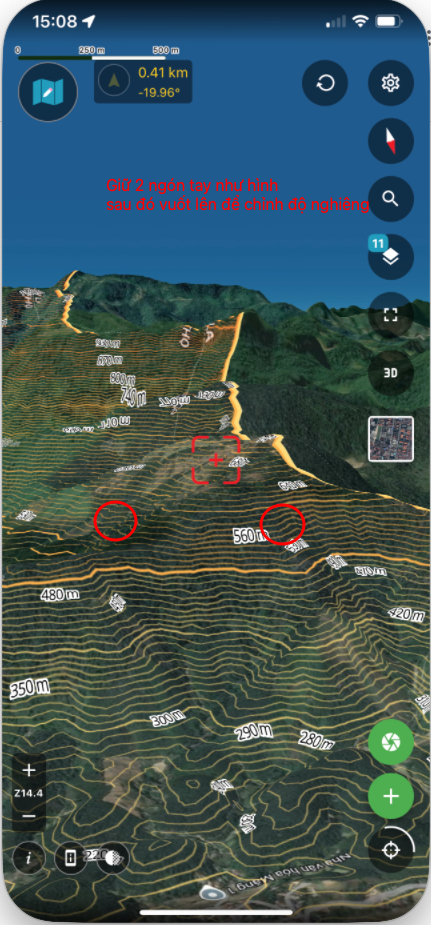
By default, the map tilt is 0, you only see a flat map. You can change the tilt by swiping two fingers on the map.